

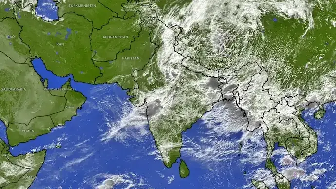
The southwest monsoon is expected to strengthen significantly across large parts of India on Friday, August 14, with the India Meteorological Department (IMD) issuing forecasts of heavy to extremely heavy rainfall in several states. The weather activity is being driven by a depression over coastal West Bengal that is moving west-northwestward, bringing moisture-laden winds and widespread rain.
According to the IMD, the weather system was centred near Kolkata on August 13 and is expected to move across Gangetic West Bengal and Jharkhand, intensifying rainfall across eastern, central and northern India.
Chhattisgarh, Jharkhand, Odisha among the worst-hit states
The heaviest rainfall is expected over Chhattisgarh, where isolated places could receive extremely heavy rainfall during the day.
The IMD has also forecast heavy to very heavy rain over:
- Gangetic West Bengal
- Jharkhand
- Odisha
As the depression continues to move inland, rainfall activity is expected to remain active across these regions over the next few days.
The impact of the weather system has already been visible. During the 24 hours ending at 8:30 am on August 13, Bhograi in Odisha and Durgachack in West Bengal each recorded 24 cm of rainfall.
Delhi-NCR and North India to receive heavy showers
The active monsoon spell will also extend to northern India.
The IMD has forecast heavy rainfall at isolated places across:
- Delhi
- Haryana
- Chandigarh
- Punjab
- Uttar Pradesh
- Jammu & Kashmir
- Ladakh
- Himachal Pradesh
- Uttarakhand
- East Rajasthan
Among these regions, Himachal Pradesh and Uttarakhand may witness very heavy rainfall at isolated locations.
Rainfall is expected to remain widespread across the western Himalayan region over the coming days, increasing the possibility of waterlogging, landslides and travel disruptions in vulnerable areas.
Why is the monsoon becoming active again?
The renewed spell of intense rainfall is being driven by a depression over coastal West Bengal, which is pulling large amounts of moisture from the Bay of Bengal into the Indian mainland.
Such weather systems typically strengthen monsoon activity as they move inland, triggering widespread rain across multiple states.
Meteorologists expect this active phase of the monsoon to continue beyond August 14.
Heavy rain likely to continue over the coming days
The IMD's extended forecast indicates that rainfall activity will persist across several parts of the country.
Heavy rainfall is likely to continue over Haryana, Chandigarh and Delhi until August 19, while eastern and central India are also expected to receive significant rainfall over the next several days as the depression weakens gradually while moving inland.
Residents in rain-prone areas have been advised to stay updated with local weather alerts and exercise caution in regions vulnerable to flooding and landslides.
Key Highlights
- IMD has forecast heavy to extremely heavy rainfall across several states on August 14.
- A depression over West Bengal is driving the active monsoon spell.
- Chhattisgarh faces the highest risk of extremely heavy rainfall.
- Delhi-NCR, Uttar Pradesh, Punjab, Himachal Pradesh and Uttarakhand are also expected to receive heavy showers.
- The active monsoon phase is likely to continue over many regions through next week.



Conversation
Be kind and stay on topic. Comments are moderated; abuse, spam and personal attacks are removed. Report a problem