

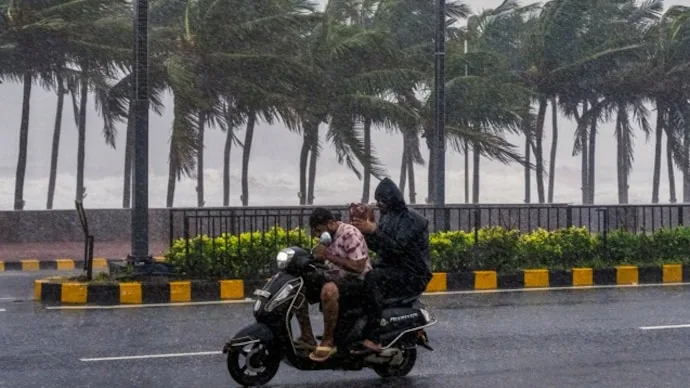

Cyclone Murasu intensified into a severe cyclonic storm over the Bay of Bengal on Monday, November 2, bringing heavy rainfall to northern Tamil Nadu and flooding several parts of Chennai. As the system moves towards the south Andhra Pradesh coast, adverse weather has disrupted flight operations, closed schools and prompted emergency measures by civic authorities.
Some flights at Chennai airport were cancelled on Monday due to unfavourable weather conditions. Passengers were advised to contact their respective airlines for updated flight information and assistance. The India Meteorological Department (IMD) issued an orange alert for Chennai, while schools across the city remained closed for the day.
Heavy Rainfall and Waterlogging in Chennai
Chennai, Chengalpattu and Tiruvallur districts have experienced torrential rainfall since Sunday night. During the 24 hours ending Monday morning, Madhavaram recorded 11 cm of rainfall, while Ennore Port and Nungambakkam received 10 cm each, according to an official.

An orange alert indicates the possibility of very heavy rainfall, generally ranging between 11 cm and 20 cm.
Greater Chennai Corporation Commissioner GS Sameeran said there was no major flooding, although minor water stagnation had been reported in some areas. Civic teams were deployed to pump out accumulated water and maintain normal movement.
Of the city's 22 subways, two experienced minor waterlogging, which was cleared shortly afterwards. All subways remained open to traffic, Sameeran said.
The corporation deployed pumps and stationed field teams with backup motors at vulnerable locations. Coordination with Chennai Police was also underway to manage traffic and monitor possible coastal flooding or wave surges.
The civic body said 28 monitoring stations recorded heavy rainfall, while five reported very heavy rain, particularly in northern areas such as Parrys and Manali.
Cyclone Murasu's Expected Landfall
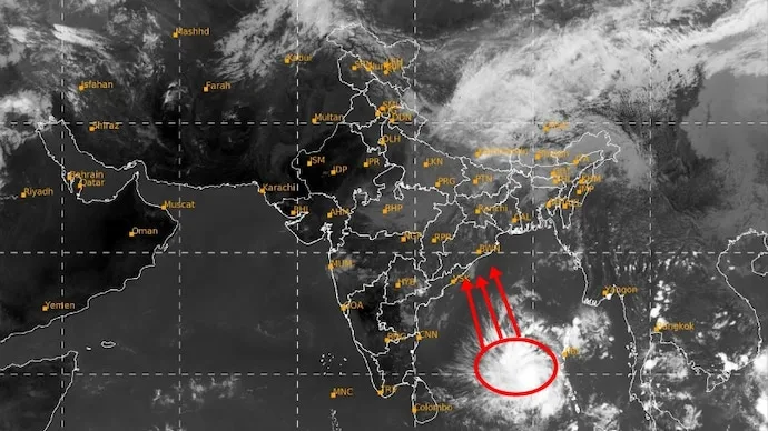
According to the IMD, Cyclone Murasu moved northwestwards at approximately 20 kmph over six hours and intensified into a severe cyclonic storm.
At 2:30 am on November 2, the cyclone was located around 260 km east-northeast of Chennai and 290 km east-southeast of Nellore.
The IMD forecast that the system would continue moving northwestwards and cross the south Andhra Pradesh coast as a severe cyclonic storm between Nellore and Narsapur, close to Ongole. Landfall was expected around midnight on November 2 or during the early hours of November 3.
The forecast indicated wind speeds of 100–110 kmph, with gusts reaching 120 kmph.
Authorities in the affected regions remain on alert as the cyclone approaches the coastline.
Official website: India Meteorological Department






Conversation
Be kind and stay on topic. Comments are moderated; abuse, spam and personal attacks are removed. Report a problem