

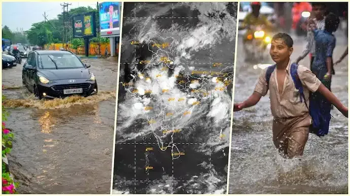

The southwest monsoon has entered one of its most active phases this season, bringing widespread heavy rainfall to several parts of India. Mumbai, Odisha and West Bengal have experienced intense downpours, while weather agencies have warned that the current wet spell is likely to continue over the coming days.
Meteorologists say favourable atmospheric conditions are supporting strong monsoon activity, increasing the risk of flooding, waterlogging and travel disruptions in vulnerable areas.
Satellite Images Show Powerful Rain-Bearing Systems
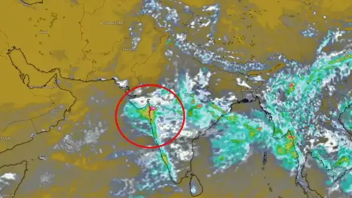
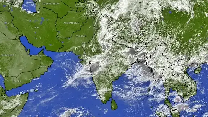
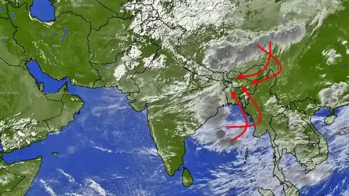
Recent satellite imagery captured by ISRO's INSAT-3DS weather satellite shows extensive cloud formations stretching across western, central and eastern India.

The images indicate two major rain-bearing systems:
- A moisture-rich system extending from the Arabian Sea across Maharashtra into central India.
- Another active weather system over the Bay of Bengal, influencing eastern India, including Odisha and West Bengal.
These systems continue to draw abundant moisture, sustaining widespread rainfall across large parts of the country.
Mumbai Faces Another Round of Heavy Rain
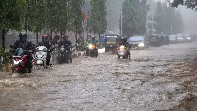
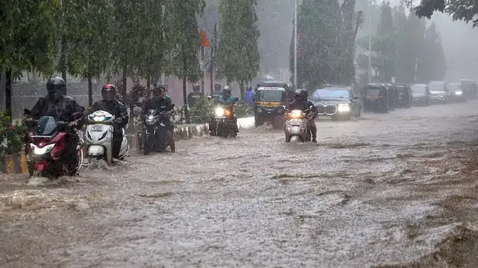
Mumbai has continued to receive heavy showers, resulting in waterlogging in several low-lying areas and affecting road traffic and public transport in parts of the city.
Authorities have advised residents to remain cautious as more rainfall is expected during the active monsoon phase.
Odisha and West Bengal See Rising Flood Risk
Continuous rainfall has also affected Odisha and West Bengal, where rivers, low-lying areas and drainage systems remain under pressure.
Local administrations are closely monitoring water levels and weather forecasts as the possibility of further flooding remains.
Residents in vulnerable areas have been advised to follow official weather alerts and evacuation instructions wherever necessary.
Why the Monsoon Has Intensified
Meteorologists explain that the southwest monsoon is currently receiving strong moisture support from both the Arabian Sea and the Bay of Bengal.
The interaction of these weather systems has resulted in:
- Heavy to very heavy rainfall.
- Frequent thunderstorms.
- Strong convective cloud development.
- Increased flood potential in several regions.
Such active phases are a normal part of the monsoon season, although their intensity can vary depending on atmospheric conditions.
IMD Forecast
The India Meteorological Department (IMD) has indicated that active monsoon conditions are likely to continue over several parts of the country.
Additional heavy rainfall is expected in parts of western, central and eastern India over the next few days, and authorities have urged residents to stay updated through official weather advisories.
Safety Precautions During Heavy Rain
People living in affected areas are advised to:
- Avoid travelling through waterlogged roads.
- Monitor official weather bulletins regularly.
- Stay away from overflowing rivers and drains.
- Keep emergency supplies ready in flood-prone areas.
- Follow instructions issued by local authorities.
The southwest monsoon has entered an active phase, bringing heavy rainfall to Mumbai, Odisha and West Bengal. Satellite imagery from ISRO's INSAT-3DS shows powerful rain-bearing systems across India, while the IMD expects the wet spell to continue in the coming days.
Key Highlights- The southwest monsoon has intensified across India.
- Mumbai, Odisha and West Bengal are among the worst-affected regions.
- INSAT-3DS satellite images show extensive rain-bearing cloud systems.
- Moisture from the Arabian Sea and Bay of Bengal is sustaining heavy rainfall.
- Flooding and waterlogging remain concerns in several areas.
- IMD expects active monsoon conditions to continue.
India is experiencing one of the most active phases of the southwest monsoon this season, with widespread rainfall affecting several states simultaneously. As weather systems continue to draw moisture from both the Arabian Sea and the Bay of Bengal, heavy rain is expected to persist. Residents in vulnerable regions should remain alert, monitor official forecasts and follow local advisories to stay safe.
FAQs1. Why has the monsoon become more active?
Meteorologists attribute the active phase to strong moisture inflow from both the Arabian Sea and the Bay of Bengal, supporting widespread rainfall.
2. Which states are most affected?
Mumbai in Maharashtra, Odisha and West Bengal are among the regions experiencing the heaviest rainfall.
3. What does the INSAT-3DS satellite show?
The satellite imagery highlights extensive rain-bearing cloud systems covering western, central and eastern India.
4. Will heavy rain continue?
According to the IMD, active monsoon conditions are expected to persist over several regions in the coming days.
5. What precautions should people take?
Residents should monitor official weather updates, avoid flooded roads and follow advisories issued by local authorities.
6. Why are satellite images important during the monsoon?
Weather satellites help meteorologists monitor cloud movement, rainfall intensity and developing weather systems, improving forecasting and early warnings.




Conversation
Be kind and stay on topic. Comments are moderated; abuse, spam and personal attacks are removed. Report a problem