


Key Highlights
- IMD has issued a warning for exceptionally heavy rainfall across parts of Gujarat over the next 24 hours.
- A stalled low-pressure system over western India is causing continuous rain and thunderstorms.
- Saurashtra, Kutch and several parts of Gujarat are likely to witness widespread rainfall through July 28.
- Meteorologists say weak steering winds have prevented the weather system from moving inland.
- Authorities have advised residents in flood-prone and low-lying areas to remain alert.
Gujarat Braces for Another 24 Hours of Intense Monsoon Rain
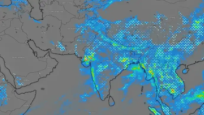
Gujarat is set to remain under the grip of an active southwest monsoon as a stationary low-pressure system continues to trigger relentless rainfall across the state. The India Meteorological Department (IMD) has warned of isolated spells of exceptionally heavy rainfall, accompanied by thunderstorms and lightning, raising concerns over flooding and waterlogging in vulnerable districts.
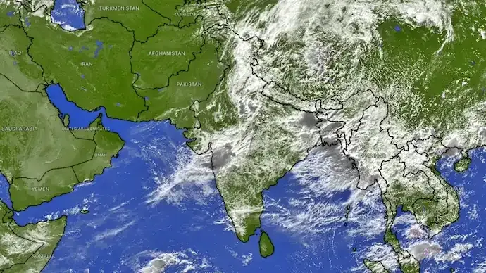
The weather system, which has remained nearly stationary over western India and the northeastern Arabian Sea, is expected to keep monsoon activity intense for at least the next 24 hours.
Why Is the Low-Pressure System Not Moving?
According to meteorologists, the prolonged rainfall is being driven by a slow-moving low-pressure circulation that has become trapped due to weak atmospheric steering winds.

Under normal conditions, monsoon systems gradually move westward or northwestward, spreading rainfall across different regions. However, the current system has remained almost fixed over Gujarat because the middle levels of the atmosphere lack the wind patterns needed to push it forward.
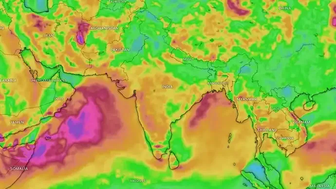
As a result, the circulation continues to pull warm, moisture-laden winds from the Arabian Sea, creating repeated rounds of intense thunderstorms over the same areas.
What Are 'Training' Thunderstorms?
Weather experts say Gujarat is experiencing a phenomenon known as "training thunderstorms."
This occurs when multiple thunderstorm cells repeatedly move over the same region, much like train coaches travelling along the same track.
The result is prolonged and extremely heavy rainfall over limited areas, significantly increasing the risk of:
- Flash floods
- Urban waterlogging
- River overflow
- Landslides in vulnerable locations
- Traffic disruptions
The active monsoon trough stretching across northern India, combined with abundant moisture from the warm Arabian Sea, is further strengthening the weather system.
IMD Forecast: Heavy Rain to Continue Across Gujarat
The India Meteorological Department has forecast fairly widespread to widespread rainfall across Gujarat from July 24 to July 28.
According to the latest forecast:
- Heavy to very heavy rainfall is expected across the Gujarat region through July 27.
- Saurashtra and Kutch are likely to receive widespread rainfall until July 26.
- Isolated locations could witness exceptionally heavy rainfall during the initial phase of the forecast.
- Thunderstorms accompanied by lightning are expected to continue across several districts through July 27.
Residents are advised to closely monitor official weather updates as rainfall intensity may vary significantly between districts.
Monsoon Activity to Extend Beyond Gujarat
The active southwest monsoon is not limited to Gujarat alone.
The IMD has also forecast heavy rainfall across:
- Konkan and Goa through July 30
- Madhya Maharashtra over the coming days
- Other parts of western India under the influence of the same monsoon circulation
These regions may also experience heavy to extremely heavy rainfall, thunderstorms and localized flooding.
Authorities Advise Residents to Stay Alert
With rivers flowing above normal levels and reservoirs rapidly filling after days of continuous rainfall, authorities have urged people living in low-lying and flood-prone areas to remain vigilant.
Residents are advised to:
- Avoid unnecessary travel during heavy rainfall.
- Stay away from waterlogged roads and flooded underpasses.
- Monitor official IMD weather alerts.
- Follow instructions issued by local authorities during severe weather conditions.
Weather experts say Gujarat is likely to remain under the influence of one of this season's most persistent monsoon spells until the low-pressure system weakens or begins moving inland.
Frequently Asked Questions (FAQs)
Why is Gujarat receiving continuous heavy rainfall?
A stationary low-pressure system over western India is continuously drawing moisture from the Arabian Sea, resulting in repeated thunderstorms and prolonged rainfall across Gujarat.
Why isn't the low-pressure system moving?
Meteorologists say weak steering winds in the middle atmosphere have prevented the circulation from moving, causing it to remain nearly stationary over Gujarat.
Which areas are expected to receive the heaviest rainfall?
According to the IMD, the Gujarat region, Saurashtra and Kutch are likely to experience widespread rainfall, with isolated areas receiving exceptionally heavy rain.
What are training thunderstorms?
Training thunderstorms occur when multiple storm cells repeatedly pass over the same location, leading to prolonged heavy rainfall and increasing the risk of flooding.
How long will the heavy rain continue in Gujarat?
The IMD has forecast widespread rainfall across Gujarat until July 28, with heavy to very heavy rainfall expected through July 27.
Which other states are likely to be affected by the active monsoon?
Konkan, Goa and Madhya Maharashtra are also expected to receive heavy to extremely heavy rainfall over the coming days.






Conversation
Be kind and stay on topic. Comments are moderated; abuse, spam and personal attacks are removed. Report a problem