



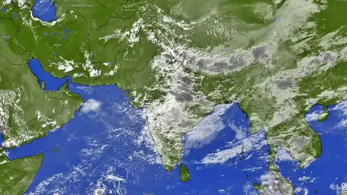
Recent satellite imagery captured from space shows a massive buildup of monsoon clouds stretching across substantial parts of India, pointing toward a revived spell of wet weather primarily over central and eastern regions. The latest thermal infrared scans reveal dense, highly convective cloud bands covering the Indo-Gangetic plains, central territories, and several eastern states. These intense atmospheric formations signal active weather mechanisms that are set to trigger persistent showers, thunderstorms, and potential downpours over the coming weeks.
Rainfall distribution is projected to remain largely uneven across the subcontinent. East India, including states like West Bengal, Bihar, Jharkhand, and the Northeastern region, is expected to experience sustained monsoon activity well into the first two weeks of September. This wet spell is driven by moving low-pressure systems and regional atmospheric circulations, bringing spells of moderate to heavy precipitation. Adjoining areas such as Madhya Pradesh are also seeing cloud formations that could further fuel localized rain events.
In contrast, large swathes of Northwest India, western states, and southern regions are anticipated to stay relatively dry compared to the active eastern belt. For the Delhi-NCR region, daytime cloud development and convective activity are likely to trigger scattered, highly localized showers and evening thunderstorms. Due to the isolated nature of these convective systems, certain pockets within the capital territory may encounter sharp, sudden rain while neighboring localities remain clear, reflecting the increasingly variable pattern of this monsoon phase.







Conversation
Be kind and stay on topic. Comments are moderated; abuse, spam and personal attacks are removed. Report a problem