



After a brief slowdown in rainfall across parts of northern and western India, the southwest monsoon is expected to revive from August 20, with the India Meteorological Department (IMD) indicating a fresh spell of widespread rain through August 24.
The renewed activity is being supported by a low-pressure area moving inland from the Bay of Bengal, along with changes in the position of the monsoon trough.
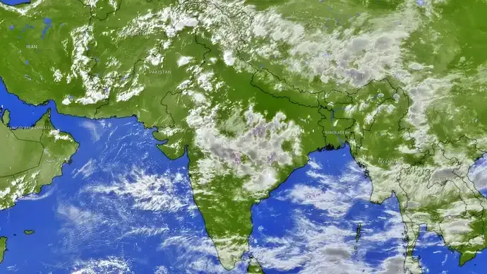
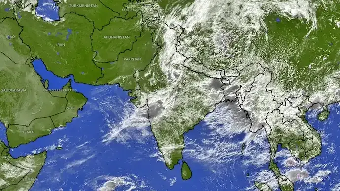
Satellite imagery has shown extensive cloud cover and convective activity over eastern and central India, signalling an increase in atmospheric activity ahead of the next monsoon phase.

Rain to intensify across East and Central India
The next few days could bring significant rainfall to several eastern and central states.
Uttar Pradesh, Bihar, Jharkhand, West Bengal, Odisha and Chhattisgarh are among the regions expected to experience repeated spells of moderate to heavy rain.
In the next 48 hours, heavier rainfall is expected particularly over eastern and central Uttar Pradesh and the foothills of Uttarakhand.
The combination of intense rainfall and saturated ground could increase the risk of:
- Localised flooding
- Urban waterlogging
- Rising river levels
- Thunderstorms
- Gusty winds
- Disruption to road and local transport
Bay of Bengal system to fuel rainfall
The developing weather pattern is being driven partly by moisture-laden winds from the Bay of Bengal.
As the low-pressure system moves inland, moisture is expected to feed cloud development across eastern and central parts of the country.
Satellite imagery has already shown dense cloud bands across eastern India, with thunderstorm activity developing over parts of Uttar Pradesh, Bihar and Jharkhand.
The system's movement and interaction with the monsoon trough will determine how far and how intensely rainfall spreads during the coming days.
Monsoon trough to influence the next phase
The monsoon trough is one of the most important features controlling rainfall distribution during India's monsoon season.
Meteorologists expect the trough to shift southward before oscillating northward later in the week. This movement could help spread rainfall towards parts of northern India.
The changing pattern could bring an end to the relatively drier conditions recently experienced in parts of Punjab, Haryana and Delhi-NCR, where relatively dry northwesterly winds had temporarily reduced humidity.
August 20 to 24 could be crucial for rainfall deficits
The upcoming active spell could be important for India's overall monsoon rainfall distribution.
Several states continue to face rainfall deficits, making the August 20–24 period significant for potentially narrowing those gaps.
Rainfall across the Indo-Gangetic plains and central India could improve seasonal totals if the active phase persists.
However, a strong monsoon revival is not uniformly beneficial. Intense rainfall over short periods can increase flooding and waterlogging risks, particularly in areas where drainage systems are already under pressure.
What should residents expect?
People in eastern, northern and central India should keep an eye on local IMD forecasts and weather warnings as the system develops.
The active phase could bring periods of heavy rain accompanied by thunderstorms and gusty winds, particularly during the peak of the weather system.
The exact intensity and location of rainfall can change as the low-pressure area moves inland, so district-level forecasts remain more useful for immediate planning.
For now, the key weather window to watch is August 20 to 24, when the southwest monsoon is expected to make another significant comeback over parts of East and Central India.






Conversation
Be kind and stay on topic. Comments are moderated; abuse, spam and personal attacks are removed. Report a problem