Shopping cart
Your cart empty!
Your cart empty!
Terms of use dolor sit amet consectetur, adipisicing elit. Recusandae provident ullam aperiam quo ad non corrupti sit vel quam repellat ipsa quod sed, repellendus adipisci, ducimus ea modi odio assumenda.
Lorem ipsum dolor sit amet consectetur adipisicing elit. Sequi, cum esse possimus officiis amet ea voluptatibus libero! Dolorum assumenda esse, deserunt ipsum ad iusto! Praesentium error nobis tenetur at, quis nostrum facere excepturi architecto totam.
Lorem ipsum dolor sit amet consectetur adipisicing elit. Inventore, soluta alias eaque modi ipsum sint iusto fugiat vero velit rerum.
Sequi, cum esse possimus officiis amet ea voluptatibus libero! Dolorum assumenda esse, deserunt ipsum ad iusto! Praesentium error nobis tenetur at, quis nostrum facere excepturi architecto totam.
Lorem ipsum dolor sit amet consectetur adipisicing elit. Inventore, soluta alias eaque modi ipsum sint iusto fugiat vero velit rerum.
Dolor sit amet consectetur adipisicing elit. Sequi, cum esse possimus officiis amet ea voluptatibus libero! Dolorum assumenda esse, deserunt ipsum ad iusto! Praesentium error nobis tenetur at, quis nostrum facere excepturi architecto totam.
Lorem ipsum dolor sit amet consectetur adipisicing elit. Inventore, soluta alias eaque modi ipsum sint iusto fugiat vero velit rerum.
Sit amet consectetur adipisicing elit. Sequi, cum esse possimus officiis amet ea voluptatibus libero! Dolorum assumenda esse, deserunt ipsum ad iusto! Praesentium error nobis tenetur at, quis nostrum facere excepturi architecto totam.
Lorem ipsum dolor sit amet consectetur adipisicing elit. Inventore, soluta alias eaque modi ipsum sint iusto fugiat vero velit rerum.
Do you agree to our terms? Sign up
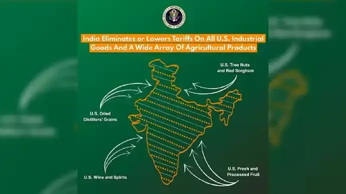
Pakistan has raised concerns with the United States after a map shared by the Office of the US Trade Representative during a trade deal announcement depicted Pakistan-occupied Kashmir (PoK) and Aksai Chin within Indian territory. The post was later removed, triggering diplomatic discussion over cartographic representation and regional sensitivities.
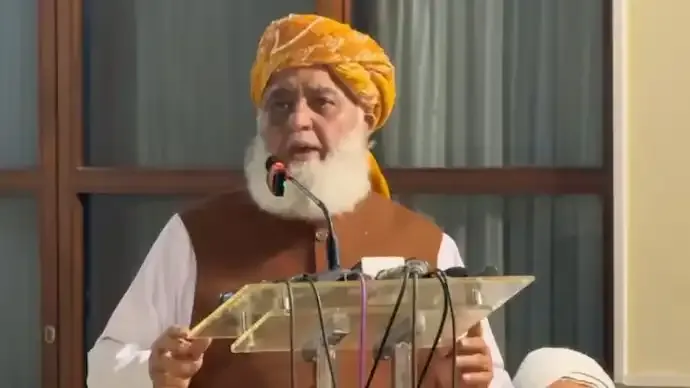
According to Pakistan’s foreign ministry, officials contacted Washington soon after the map appeared online, arguing that the depiction did not align with what Islamabad considers internationally recognised boundaries. Spokesperson Tahir Andrabi stated during a media briefing that Pakistani authorities highlighted their objections directly to US counterparts, following which the post was deleted from the official account.
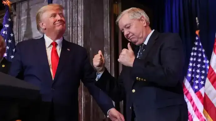
The map surfaced shortly after India and the United States unveiled a framework aimed at strengthening trade ties and reducing tariff barriers. While the agreement itself focused on economic cooperation, the accompanying visual material drew attention due to its portrayal of the disputed Himalayan region. Observers noted that the map appeared to show the entire Jammu and Kashmir region, including areas administered by Pakistan and claimed by China, as part of India.
The controversy highlights the sensitivity surrounding territorial representations in South Asia, where border disputes remain a central geopolitical issue. Pakistan reiterated its stance that Jammu and Kashmir is a disputed territory, referencing resolutions linked to the United Nations Security Council. Islamabad also welcomed what it described as corrective action by the United States after the post was removed.
India has not issued an official reaction to the deletion of the map, though the depiction sparked debate among analysts about whether the image represented a policy shift or a simple design error. Some observers suggested that the incident reflects the complex balancing act Washington faces as it deepens strategic ties with New Delhi while maintaining diplomatic engagement with Islamabad and Beijing.
The episode unfolded against the backdrop of improving economic cooperation between India and United States, with both sides exploring expanded market access and investment opportunities. The trade framework, described as a step toward broader economic alignment, has already drawn attention for its potential impact on regional commerce.
Cartographic controversies have periodically influenced diplomatic relations in South Asia, where maps are often viewed not merely as geographic tools but as political statements. Experts note that even minor visual representations can trigger strong reactions due to the historical and strategic significance of disputed territories such as Kashmir and Aksai Chin.
While the US Trade Representative’s office has not publicly explained the reason for removing the post, the incident underscores how digital communication by government agencies can carry geopolitical implications. As discussions around trade and regional stability continue, the episode serves as a reminder of the delicate nature of territorial narratives in international diplomacy.
54
Published: Feb 13, 2026

All India Story is your trusted source for comprehensive and up-to-the-minute news coverage across India. Bringing you the latest on politics, business, technology, entertainment, sports, and more, we are dedicated to keeping you informed with accurate, engaging, and insightful stories from every corner of the nation.