

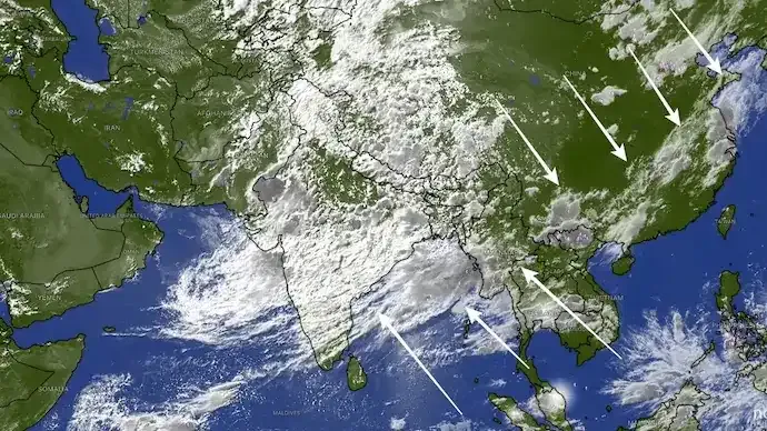

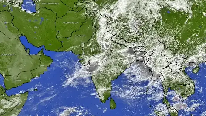
A vast monsoon cloud band stretching nearly 10,000 kilometres from northern India to South Korea has been captured in recent satellite imagery, signalling one of the most active phases of the 2026 southwest monsoon across Asia.
The enormous weather system, known as a monsoon convergence zone, extends across northern India, the Himalayan region, parts of China and East Asia, creating a broad corridor of clouds, thunderstorms and widespread rainfall.
Meteorologists say the system is contributing to above-normal rainfall across several parts of India and is expected to keep monsoon conditions active in the coming days.

What Is a Monsoon Convergence Zone?
A monsoon convergence zone forms when moisture-laden winds from the Indian Ocean meet other atmospheric weather systems over the Asian continent.
As warm, moisture-rich air converges and rises, it cools and condenses to form extensive cloud cover and rain-bearing systems capable of producing widespread showers and thunderstorms over large areas.
Such weather patterns are common during an active monsoon phase but can occasionally expand across several countries, as seen in the latest satellite observations.
Heavy Rainfall Recorded Across India
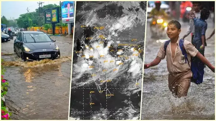
The current weather system has brought a significant increase in rainfall across India.
According to recent rainfall estimates:
- Several regions have recorded rainfall well above seasonal averages.
- The country has experienced one of the most active monsoon spells of the season.
- The rainfall is expected to improve the overall seasonal monsoon performance after earlier uneven distribution.
The active phase has already delivered heavy rainfall across parts of:
- Uttar Pradesh
- Uttarakhand
- Punjab
- Haryana
- Delhi-NCR
- Rajasthan
- Several eastern and northeastern states
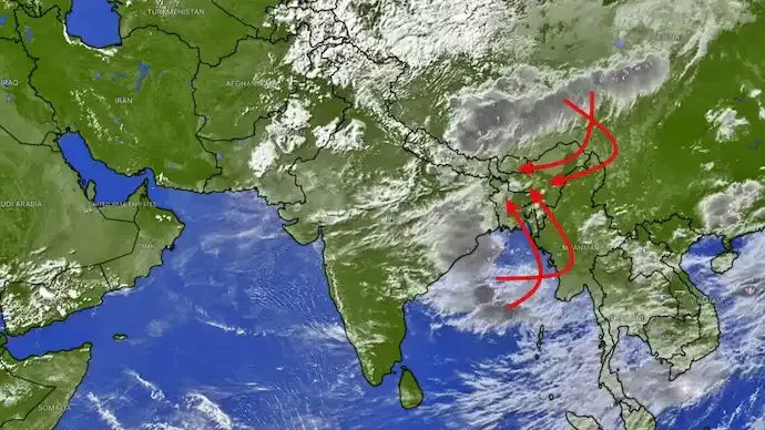
Low-pressure systems originating over the Bay of Bengal have also contributed to widespread precipitation.
Benefits for Agriculture and Water Resources
An active monsoon is expected to provide multiple benefits, including:
- Improved soil moisture for kharif crops
- Better reservoir storage levels
- Reduced seasonal rainfall deficit in several regions
- Improved water availability for agriculture
Farmers and water resource managers often welcome sustained monsoon activity after periods of below-normal rainfall.
Flood and Landslide Risks Remain High
While the rainfall is beneficial for agriculture, authorities have also cautioned about weather-related hazards.
Areas vulnerable to heavy rainfall may face:
- Flash floods
- Urban waterlogging
- Rising river levels
- Landslides in hilly terrain
States such as Uttarakhand and Himachal Pradesh remain particularly susceptible because of their mountainous geography and continued rainfall.
Residents in vulnerable areas are advised to follow weather advisories issued by local authorities.
A Weather System Spanning Much of Asia
The satellite imagery also highlights the interconnected nature of Asia's weather systems.
Although India's southwest monsoon is primarily driven by seasonal winds over the Indian Ocean, it often interacts with broader atmospheric circulation extending across the Himalayas, China and the western Pacific.
The current cloud band demonstrates how large-scale weather systems can simultaneously influence rainfall across multiple countries.
Monsoon Expected to Stay Active
Meteorologists expect the southwest monsoon to remain active over several parts of India during the coming days.
If the current weather pattern continues, it could further improve seasonal rainfall while supporting agriculture and replenishing reservoirs, although authorities continue to monitor regions at risk of flooding and landslides.
Key Highlights
- A 10,000-km-long monsoon cloud band has been observed stretching from India to South Korea.
- The weather system represents an active monsoon convergence zone across Asia.
- Several Indian states have recorded above-normal rainfall.
- The rainfall is expected to improve seasonal monsoon performance and benefit the kharif crop season.
- Authorities have warned of possible floods, waterlogging and landslides in vulnerable regions.
- Meteorologists expect active monsoon conditions to continue over the coming days.
Frequently Asked Questions (FAQs)
What is the 10,000-km monsoon cloud band?
It is a large monsoon convergence zone stretching from northern India across the Himalayas and parts of East Asia, producing widespread cloud cover and rainfall.
Why is this weather system important?
It signals an active phase of the southwest monsoon and is contributing to above-normal rainfall across several parts of India.
Which areas are receiving heavy rainfall?
Heavy rainfall has been reported across parts of northern, central, eastern and northeastern India, including Uttar Pradesh, Uttarakhand, Punjab, Haryana, Delhi-NCR and Rajasthan.
Can heavy rainfall cause flooding?
Yes. Authorities have warned of flash floods, waterlogging, landslides and rising river levels, especially in Himalayan states.
How does this benefit agriculture?
The rainfall improves soil moisture, supports kharif crops, replenishes reservoirs and helps reduce seasonal rainfall deficits.
Will the active monsoon continue?
Meteorologists expect active monsoon conditions to persist over the next few days, although rainfall intensity may vary by region.





Conversation
Be kind and stay on topic. Comments are moderated; abuse, spam and personal attacks are removed. Report a problem